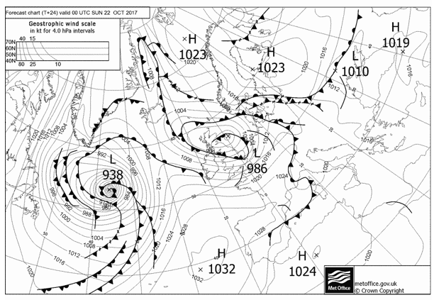
With the recent ex-hurricane Ophelia becoming a record breaker as the most east Atlantic hurricane on record and a few more aggressive looking storms rolling across the north Atlantic to northern Europe, the weather has turned more unsettled in the Mediterranean.
This is only good for the start of the race. Initial prognosis a week ago suggested a light wind start and a little bit of slow get away, but now an active cold front will slip south providing a moderate to fresh NNE airflow that will chase the fleet towards the Gibraltar Straits.
The cod front looks set to become slow moving which means the unstable airmass will remain with the boats for some time and it is likely that there will be some significant showers and overnight thunderstorms associated with it.
After the boats have done the inshore lap of sausage triangle for the spectators of Alicante the teams will be locking into offshore mode sailing and boat speed, as they set off in 13-16 KT NE .
Breaking the Leg down in to three parts we can see where there might be potential splits and focal points in the race.
Start to the Straits
Unusually so, this part of the race looks the least complicated. Conditions will be unstable and there is a risk of some showers/thunderstorms associated with the cold front and along convergence lines off headlands but ultimately the first part will be downwind sailing on the A3.
The breeze is expected to be 14-17 KT decreasing to 10-14 KT from the NE becoming ENE and eventually E when they reach the Gibraltar Straits on
Initially out of Alicante, there may be a period of the MH0 depending on the wind direction but it won’t be long before they will all be peeling to the A3. There will probably be a bit of a waiting game between some boats but when one goes they all will as once at Cabo de Palo it is VMG all the way to the Straits.
Of all the sails in the locker, this proved the hardest sail to find consistent speed on and those teams with time and experience will definitely have an edge. If last race was anything to go on then this is where Team Brunel could show some speed.
As the fleet head off SSE on a long port gybe the wind will be moving with them, the risk here is that anyone that is slightly slow will potentially begin to appear slower as the wind decreases from the east first.
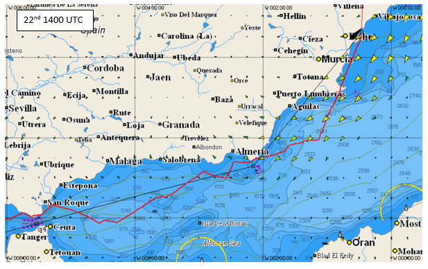
The first real action will be in the middle of the first night and the teams set up to make the most of the acceleration and shift of Cabo de Gata where they finish the prologue early. It is likely that you will see some potential place changes here for those that really get the headland positioning right or possibly due to some significant cloud development. Last time there were massive eye blinding thunderstorms in this area which made transitioning this headland quite hard. Keeping an eagle eye on the Radar onboard will be useful to pre-empt this.
The boats will then continue VMG downwind sailing to the Gibraltar Straits picking their moments to gybe and position themselves for their approach to the Straits. This time last year there was a bold split and onboard TeamSCA we took the decision to make a northerly approach verses a southerly approach to the Straits, however it is fairly clear there will be less wind south.
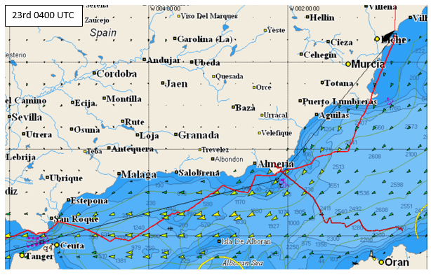
I expect all teams to follow the same route and be preparing for short gybing through the Straits with plenty of pressure expected tide isn’t really a concern especially as it is pretty hard to get out of anyway. The breeze will steadily build the other side as the high pressure that dominates begins to get squeezed from the south by a shallow low off Morocco and a trailing front associated with a low pressure over northern Europe. This will maintain a narrow band of easterly wind initially in excess of 30 KT that will hold the fleet on the WSW course to stay in the wind and pick their moment.
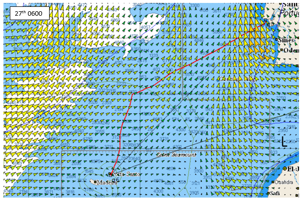
Straits to Porto Santo
Here is where it gets interesting and uncertain as the wind is going to begin to decrease through this leg as the high pressure continues to be squeeze between the shallow low of Morocco and the low pressure systems and trailing fronts over northern Europe. The result is a slack airflow.
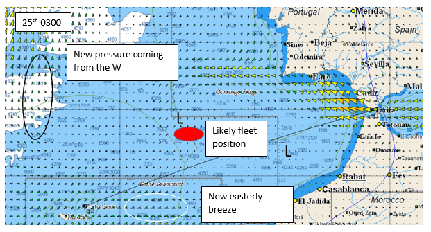
By midnight on the 25th the boats will be becalmed and the fleet will be compressing again. It’s difficult to have any real confidence in routings in areas of less than 5-6KT and instead the teams will be trying to identify the bigger picture features that have shown consistency to help them position themselves.
The options are fairly limited and positioning will be relative to the fleet and the feature,
- The shortest route – whatever takes you nearest to Porto Santo
- The new wind to the south
- The slow moving new breeze from the WNW which will eventually give them the blast home once round the island
Porto Santo to the finish
Clearly now the forecast we are looking at is many days old and the accuracy is very limited. The big picture features will still hold true with a downwind leg and more pressure both N and W before the acceleration around the Portuguese coast.
Looks like it will build from sub 10 KT to end 25KT plus with ETA now early morning on the 28th.
Will they do this in one gybe? Come back on the 26th to see who made it to Porto Santo first, how fast they did it in and will they hold on to their lead?